We have produced at great time and expense two short videos to music of our travels which may not worry Steven Spielberg much but hopefully relate some of the fun of our summer's walk....
Video 1 Nature Song and Video 2 Been Everywhere Man
Saturday 19 December 2009
Friday 27 November 2009

Tuesday 17 November 2009
Photo gallery for our 650 mile hike thru New Mexico now online
We have uploaded photos for the first US state we walked through - New Mexico. These can be seen here....

Monday 19 October 2009
Our final 2 weeks in the US....
 We rented ourselves a car for the last 2 weeks so that we could become 'normal' tourists for a while. First, we took the car down to visit the Martin family and managed a couple of short hikes with MaryJoy.
Canyonlands National Park Utah
 This is Chaco canyon in New Mexico......
 A lovely camp with the last rays hitting monument valley in Arizona.......
 The San Juan river has cut through the sandstone to leave these wonderful river meanders- Goosenecks State Park Utah.

Slot canyon in Canyonlands National Park Utah
We then travelled south and visited some nice desert areas in New Mexico, Utah, Arizona and southern Colororado. 

Arches National Park, Moab Utah
 This is Chaco canyon in New Mexico......
 A lovely camp with the last rays hitting monument valley in Arizona.......
 The San Juan river has cut through the sandstone to leave these wonderful river meanders- Goosenecks State Park Utah.
Slot canyon in Canyonlands National Park Utah
Thursday 1 October 2009
Some photos from the final furlong.....
The long straight road across Wyoming's Great Basin. We walked 23 miles in a straight line on this day.....

The sun and lack of shelter required some novel solutions. In this case lunch was under the tent propped up to allow the wind to flow around. Surprisingly- it worked!

 We reach the 2000mile mark and celebrate with some artwork using local materials and powerbars!
Martina at our finishing point on September 26th- Battle Pass Wyoming. The next challenge was to make it to Denver , Colorado- it took four hitch hikes and two buses to get there. Ready for a rest.......!

Sunday 27 September 2009
...Reader, I Married Him

Dear readers,
from the lofty Wind River mountains we were washed into the Great Basin of Wyoming by a spell of wet weather. The Great Basin is a curious natural feature where the Devide actually splits in two: in the basin itself, water just goes "down" and seeps into the ground. Mountain ridges either side of it shed the water into Pacific (Green River) and Atlantic (Sweetwater River and Platte River) respectively. What falls in between just soaks in! It is a high plateau covered in silvery sage, inhabited by antelope (more of these later) and wild horses. No shelter, no people, no towns for mile - and very little water. 120 miles of this - our final challenge!
After a recovery stop in the town of Lander (home that weekend of the annual "one-shot-antelope-hunt" - it seems we were lucky to get a motel room!) we headed into the sage desert in bright sunshine. Here we crossed path with the Oregon Trail, the Overland Trail, the Pony Express and the Mormon Trail - thousands of hopeful souls who crossed these waterless plains in search of brighter futures in the 19th century. Now there's just a big network of trails for the benefit of people who want to shoot wildlife it seems.
The pronghorn antelope isn't one (an "antelope" I mean), actually. It's the only exponent of a family of ungulates unique to the USA and wonderfully adapted to being on every predator's dinner menu between the ice ages: it is the fastest runner in the Western hemisphere at 60 mps - and not just for a sprint but for about an hour solid if necessary - it has very sharp eyesight and can spot things at 3-4 mile distance (or so I read on the WWW), it is certainly very wary of two legged animals walking towards it - we never got closer than 300 meters to any of them. Unfortunately it doesn't seem concerned about things on wheels (a bit like the sheep on Skye) which, given that your average American hunter shoots from the truck window, is rather a shame for the species. They also are the only animal that grows proper horns (as opposed to antlers) and then sheds them every year. We didn't find any though.
On day 3 in the basin we camped by a little cow infested yet promising spring under benign cumulus, tent turned into a mild Westerly evening breeze - only to wake 2 hours later to the tent being flattened by a Northerly gale with snow ... bell-end departed company with the pegs and someone (a man's job this, surely) had to go out in the lashing storm (in underpants) to re-peg the whole mess. The next morning, snow lay on all the hills around us and an icy Northerly continued to blow us infront of itself down the endless straight jeep-roads that serve as the CDT in the Basin.
This morning, we descended from our last Divide peak (Bridger Peak 11,000ft) to a trail head at Battle Pass. This is the pass where we set out in 2004 on a 300 mile taster-hike along the CDT, the end of which was Dillon Lake in Colorado (where we started this year's Colorado Southbound hike) ... sigh ... sorry to be so complicated. The upshot is that this morning we completed to make a set of footsteps between Mexico and Colorado on the CDT (with 300 miles of steps from 2005). This year we have walked 2,100 miles.
Now we are finished
Now our feet get a chance to recover
Now we must eat lots so as not to frighten our parents on our return
Now we will hire a car for 2 weeks and be tourists
It doesn't seem real yet
We've done it!
Thanks to all the lifts and support and spontaneous help we have had.
It's been FAB
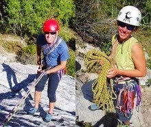
ps thanks to Tom and Debbie , Florida for the rare photo of the 2 of us hiking....
Thursday 17 September 2009
Southern Wind Rivers.......
We pride ourselves in pitching the tent quickly, but maybe not this speedily !!
Our trek along the Wind River mountains of Wyoming has now been completed. We made it to the southern edge of the mountains in prairie country at South Pass City. Its been a great hike taking about 11 days. And autumn is on its way.....
Our tent (middle bottom of photo) lost in granite slabs, lakes and mountains. Spider Lakes, Wind Rivers Wyoming.


Our trek along the Wind River mountains of Wyoming has now been completed. We made it to the southern edge of the mountains in prairie country at South Pass City. Its been a great hike taking about 11 days. And autumn is on its way.....

The supermarket in Pinedale, Wyoming shows that we are in hunting country..........

Our tent (middle bottom of photo) lost in granite slabs, lakes and mountains. Spider Lakes, Wind Rivers Wyoming.

Martina makes a river crossing with Warbonnet Peak looming above.

Tent at sunset

We approach the Cirque of the Towers looking like the Skye ridge in Scotland - with Scottish weather. 

Cirque of the Towers. Two classic rock climbs here- Pingora Peak's right hand skyline and the Wolf 's Head in the middle.

The end of the mountains... We hit prairie and dirt roads heading for South Pass City, Wyoming

Friday 11 September 2009
Wind River photos II
Some close up shots in the Wind Rivers - primrose,lichen columbine. And Brian hitching from Jackson back to the trail at Togwatee Pass, Wyoming- the Grand Tetons provide a nice backdrop while we wait!


Wind Rivers Wyoming- some photos
Here are some shots from the Wind Rivers which give a flavour of our hike.....


Mountains of Light and Wind
We have just returned from 6 days of walking through the Windriver mountains. Again we spurned the CDT propper for a more adventurous and wilder route, but moving steadily South.
We started out in the town of Dubois (pronounced: Doo-Boys) and after aprox 15 miles of trail into the Fitzpatrick Wilderness, left preformed trails and notions behind and headed straight up Shale Mountain over a wild, broken plateau of tortured looking granite slabs and not much else. It was freeing to be rid of the trail! Our route led through wildly undulating landscape past deep blue lakes rimmed by snowpatches and steel granit slabs. Every 20 minutes the views changed completely. Small alpine flowers gave it their best before the onset of winter: purple primroses, alpine asters and sunflowers.
One afternoon a thunderstorm brewed above our heads and out of nowhere, lightning struck a cliff 200 meters above us. We could see a small cloud of smoke or rockdust followed by a chunk of rock tumbling into the valley. The electric discharge increased our walking pace valleywards considerably.
We spent fun hours bush-wacking through blowdowns and burns until we got to the valley of the Green River and the Green Lakes. The river eventually joins the Colorado (in the state of Colorado) and flows to the Pacific - or rather it doesn't make it there for abstraction and damming, but that's where it is headed.
From the Greenriver Valley we crossed into the stunningly jagged Titcomb Basin via a coll called Knapsack Pass which sounds like fun and picknicks but turned out to be a pretty hair raising lose-boulders and semi-frozen scree affair. Luckily the glacier hanging under the far side of the pass had retreated and softened (thank you global warming) significantly and we were able to leave the tottering boulder fields and run down the ice (much safer).
In Titcomb Basin (did I mention it is very beautiful?) we made a base-camp and the next day climbed the 2nd highest peak in the Windrivers: Fremont Peak at 13700 (or there abouts - map and guidebook could not agree on its actual hight) to gain wonderful views of the area (did I mention it is VERY beautiful?).
There was a puzzling absence of wildlife in what is a huge wilderness area. None the less we saw 2 moose, an osprey carrying a fish, the first marmot (yellow bellied) since Glacier National Park as well as the usuals small friendly mammals (Pika, Chipmunk)...and a dead horse (!?).
Now we are resting in Pinedale and are heading back for a 2nd part of the Windrivers tomorrow. Hoping to post some pictures at the next stop (did I mention it is very beautiful here?)
Thursday 3 September 2009
Leaving Griz-country

One day in Yellowstone National Park we had just descended into the big valley formed by the Yellowstone River upstream of the big Lake, when we saw 2 horses and 6 mules trotting along the path towards us. They were riderless, bridle-less and looking very noughty. None the less, the lead mule walked right up to me (even as I stepped off the trail to let them past), sniffed my hand which I extended in welcome, and then gave me a dismissive looked and lead his little herd on past us and towards the Lake. 40 minutes later, a gentleman and a black horse gallopped past us as we were sheltering from a rain shower under a large pine. A further 3 hours later, the same gentleman overtook us again, leading 2 horses and 6 mules, all looking very guilty, dusty but also slightly smug. " Don't know where they thought they were headed, " he said to us as he passed. "Home?" I suggest - after all, camping in grizzly country for nights on end is pretty nerve wrecking ...
PS: that is NOT one of our photos thank goodness! We've still not seen any bears though lots and lots of signs of their omnipresence! We are now heading South and up (in terms of elevation) and will soon be out of range of the Grizzly bears. The one above is shown in full flight - they can sprint at 30 mph apparent!
Friday 28 August 2009
Yellowstone National Park
Being off the CDT has been great fun! For the last 8 days, we have been in Yellowstone National Park, walking through the park on a route East of the caldera and lake. This is the serengeti of the USA! We've seen lots of buffalo (bison!), herds of antilope (they are not real antilope but that's what they call these aninmals here), elk (wapiti deer) and their shed antlers (too heavy to carry - alas!), wolf tracks (lots!) and more evidence of bears than is good for a peacefull night of sleep: the euphemistacally named "bear cake", hairs stuck to trees, scratch marks 3 meters high on trees and foot prints (look a lot like naked human feet). We also saw a badger, a fox, coyote, two toads and two frogs and the last third of a snake! Still waiting to see moose.
Because this is Yellowstone, we've also walked past steaming springs, lots of interesting vulcanic rocks and other signs of the areas eruptive past. Particularly amazing are pieces of fossilised wood that lie around here and there - some red, some white with clearly visible fibre structure of wood which could easily be mistaken for bleached bits of old timber ... but they are 50 million years old! At the North edge of the park we passed an erroding hillside where whole logs of these trees were exposed.
Today we are resting after 9 very hot days in a row (still can't cope with the heat!) in Cody, tourist town and famous for Buffalo Bill's travelling show of "the Wild West". He practically invented the whole romantic cowboy thing.
Brian has worn out his 3rd pair of shoes and my hiking dress (dress number 2) is starting to fall to pieces so we will be shopping for new apparel.
Deliberating over whether to hike a detour through the Tetons or whether to rejoin the CDT in 4 days distance and continue straight towards the Windriver mountains on the CDT.
Wednesday 19 August 2009
South Montana images
Martina walks towards the Tobacco Root Mountains with storms coming in! 
Maddison river south Montana near Ennis Lake

Frost in the valley
Brian dries the tent

Spanish Peaks, Montana


Maddison river south Montana near Ennis Lake

Frost in the valley

Brian dries the tent

Spanish Peaks, Montana

Jefferson river hot pool 

Snake that shared the Jefferson river hot pool with us!

Interesting shop in Montana

wild flowers including paintbrush and asters in the valley


Saturday 15 August 2009
Big Sky Variant (aka the Butte Super Cut-Off)
Dear Reader, please be not be alarmed when we tell you that we have parted company with the CDT (for now)! We are still hiking, just not on the CDT. And we are still moving South in a continuous line, just not on the CDT. Why not the CDT? Well, compared to our new chosen route, the CDT is slightly longer and reputedly offers just more of the same i.e. trees, trees, trees.
We will meet the CDT again in South Yellowstone however, to follow it through the Windriver Mountains to the end (to Colorado).
So we are now on what B likes to call the "Big Sky Variant", a line going from Whitehall more directly South than the CDT. We've just crossed a lovely mountain range called the Tobacco Root Mountains and are headed for the Spanish Peaks. Should be in Yellowstone NP in about a week.
On our way into the Roots, we got a tip-off from a passing local (as well as a cold can of Miller Light each!) to stop by some lovely wild hot springs in the Jefferson River Valley. They were literllay on route and we gladly stripped off and hopped in. We even had a little bathing companion in the form of a small swimming snake who paddled past my shoulder, head above water, beady eyes looking at me slighly annoyed at being disturbed. Sunflowers were framing the scene and an eagle was flying overhead! Apparently there are petroglyphs on the hill nearby. As soon as we were out of the water, the little snake was back.
Yesterday it rained quite a bit, so last night we went into the town of Ennis (very nice!) and got a cabin and watched "Butch Cassidy and the Sundance Kid" on video in the evening. Today we head for the Spanish Peaks.
Saturday 8 August 2009
Central Montana- Photos from Scapegoat Wilderness to McDonald Pass


the best show in town (if you are a cow)...

Thirsting for our blood ... mosquito stalking the outside of our tent ..

Subscribe to:
Posts (Atom)